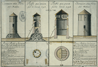
The Gibraltar National Archives is pleased to present ‘Mapping our Past’ a new exhibit showcasing the beauty of
maps, plans and other cartographic curiosities from our Special Collections.
Opening at the Fine Arts Gallery, Casemates on Wednesday 26th October, running to Friday 11th November, 2016.
View Exhibition Video

Mapping our Past exhibition is part of the Gibraltar National Archives outreach programme
for 2016. The aim of the exhibition is to publically showcase an original, representative sample of our extensive,
physical and digital cartographic holdings. The exhibition will combine analogue (physical) and digital components.
A combination of technical as well as artistic styles, are brought together,
including important contributions from the Royal Engineers Regiment as well as City Council later Public Works draftsmen, surveyors, and engineers.
Additionally, important pieces from historical cartography, some unique, provide a diverse blend.
The showpiece is an over-sized, framed, 18th Century, Map of Gibraltar,
created by Major
Charles Warren, Royal Engineers.
The physical set of cartography on display will be complemented by a large record-set
of digital maps, plans and other cartographic curiosities electronically accessible via an over-sized touch display.
Database of Exhibits on display (107)
| ExhibitID | Year | Description |
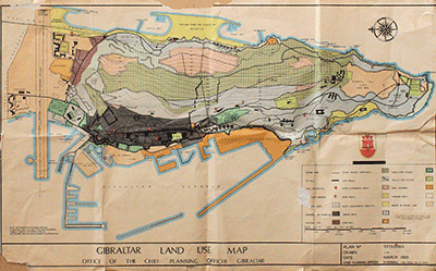
| 1 | 2016 | Gibraltar Ordinance Survey Map Keith Madeira GLIS coordinator 2016. W110cm x H61cm. |
| 2 | 1996 | Proposed re-development of Casemates Square and surrounding area 1996. W85cm x H62cm |
| 3 | 1996 | Proposed plan for Grand Casemates formal garden 1996 W85cm x H62cm |
| 4 | 1996 | Proposed plan and elevation of shopping area (rear of barracks) 1996 W85cm x H62cm |
| 5 | 1988 | Plan of the Convent Gibraltar Government Archives Premises as existing in 1988 Gibraltar Government Public Works Department 242/65 A. Peralta 1988 W66cm x H47cm |
| 6 | 1975 | Map of Action Area 3 Rosia Bay amendments 1975. W125cm x H72cm |
| 7 | 1966 | Blue-print of proposed opening at Charles V Wall Southport Gate M. I. Mun City Engineer and Surveyor 1966 W105cm x 70cm |
| 8 | 1965 | Plan detailing the buildings on Main Street with coloured legend indicating state of repair undated. Part 1 C1965 W120cm x H70cm |
| 9 | 1965 | Plan detailing the buildings on Main Street with coloured legend indicating state of repair undated Part 2 C1965 W120cm x H70cm |
| 10 | 1965 | Plan detailing the buildings on Main Street with coloured legend indicating state of repair undated Part 3 C1965 W120cm x H70cm |
|
Digital highlights include the following:

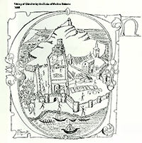
- Plano de la Toma de posesion de Gibraltar por el Duque de Medina Sidonia, 1468.
- Africa Pars, Anton Van Den Wyngaeride, 1567.
- Gibraltar, Anton Van Den Wyngaeride, 1567.
- Gbvelaltar, Anton Van Den Wyngaeride, 1567.
- La vaja de Jibraltar, Cristobal de Rojas, 1608.
- Estrecho de Gibraltar, Luis Bravo de Acuna, 1627.
- La trama urbana de Gibraltar, Luis Bravo de Acuna, 1627.
- Monte y ciudad de Gibraltar, Pedro Texeira, 1634.
- The plane of the town of Gibraltar, Edmund Drummer, 1685.
- Die fahrt von Cadiz nach Malaga durch die Straasse oder Meer-Eng von
Gibraltar aus dem Ocean in das Mittellaendische Meer (The trip from Cadiz
to Malaga by road or sea close of Gibraltar from the Ocean
in the Netherlands Sea), 1704.
- Geometrical plan of the town, mountain and bay of Gibraltar, 1710.
- Mapa de la bahia de Gibraltar con el proyecto para ocupar y fortificar las Algeciras, Marquez de Verboon, 1722.
- Plano del Norte de Gibraltar con los ataques ejecutados, 1727.
- Series of coloured plans showing the external defences of Gibraltar under Lt General Sabine Governor of Gibraltar. Jonas Moore, 1732.
- Plano de la Plaza de Gibraltar y de la linea de los espanoles, 1740.
- Demostracion de un barco armado con su escala de cien hombres para dar el asalto a la plaza de Gibraltar, 1742.
- Plan de ataque a la plaza y penon de Gibraltar. Con navios mercantes de 64 canones transformados en baterias flotantes incombustibiles y insumergibiles, 1781.
- Idea extravagante para tomar la plaza de Gibraltar, 1782.
- Chart of the bay of Gibraltar, J Drinkwater, 1785.
- Plan del Proyecto de las obras para el bloqueo de Gibraltar, 1787.
- Vista de Gibraltar y modo de incendiar los barcos en su bahia, 1805.
Further to the items highlighted above a large number of digital maps and plans from the 15th to the 21st Centuries are now available for viewing by contacting us.
Art of Cartography

Cartography is the study of map-making, that combines science (framed in geometry), aesthetics and technique.
The purpose of a map is to communicate spatial information about the world.
Notwithstanding the fact that mapping practises based primarily in science play a very important role in any cartographic endeavour,
it does not, however, assist the essential artistic design elements such as choice of colour, symbols or lettering.
These elements are just as important to the overall purpose and effectiveness of the map because important aspects of science and
art are implicitly ground together. A high-quality map therefore, combines a blending of good science and good art
into an effective tool of communication.
Post-renaissance cartography clearly presents the separation of place and space in ways that may be interpreted as
analogous to the acquisition, management and reinforcement of imperialism and colonialism. Fortification as well as
building in general, implemented from detailed observation, cartographic study and design, was and still is a way of
broadcasting established power and control. Over the ages maps have been used not only to represent space but also to
establish the identity, the legitimacy and the agency of individuals, groups and ventures. Consequently, maps are profoundly
implicated in the disruption of ‘natural order’.
Cartographic history is consistent with the development of modern scientific practise founded on geometry and projection.
Before science’s claim to cartography, map-making was an activity mostly carried out by families, clans or tribes.
In this context making a map invariably was an occasion for the display of artistry. Cartography thus, acquired cultural meaning.
Today’s tendency of modern art to separate itself from aesthetics has brought about a continued albeit critical engagement
from avant-garde artists with cartography.
Maps have served the notions of beauty, ugliness and utilitarianism, having been used as floor-mosaics, frescoes, tapestries
and wall-hangings since early times. As from the early seventeenth century maps became collectors’ items.
Today we celebrate the ancient art of cartography the liberator of place from space.

Paradoxically, however, the dawning of a
new age of technology that allows the seeing of the whole at one view may impinge on personal confidentiality by
the emerging use of digital cartography as a means or tool of surveillance.
A W Pitaluga
Archivist
Gibraltar National Archives
2016